Here's the mileage:
Ballyvaughan to Kilrush - 70 km
Kilrush to Dingle (including a ferry ride over the Shannon) - 108 km
Dingle peninsula loop - 47 km
Dingle back to Kilrush (with the ferry again) - 108 km
total: 333 km, or roughly 207 miles
This may not seem so bad but we did it going about an average of 40-45 miles per hour. So this blog is entitled Dingle in a Day but it could also be called Trial by Fire on How to Drive in Ireland on Every Imaginable Type of Road. Did I mention that I drove the whole way?
Dingle is the main town on the Dingle peninsula, and it's a lot like Annapolis in high summer, so we didn't bother to take pictures while we sat in traffic trying to get the hell out of town. The Dingle loop is a small road that skirts the peninsula...mountains (and lots of sheep) on your right and breathtaking views of cliffs and the Atlantic Ocean on your left.
 |
| Garraun Point on the Dingle peninsula |
 |
| Great Blasket Island and the ferry from Dingle |
 |
| Most of the loop had a one lane road like this. The dotted yellow line to the right is a pull off spot so tourists like us can take pictures. If another car came by going the other direction, you both slowed to a crawl and narrowly inched by one another without falling off a cliff or jamming your car into a rock wall. Good times. |
 |
| rocks off of Slea Head, the western-most point in Ireland |
 |
| view coming up from Tralee to the Dingle peninsula |
 |
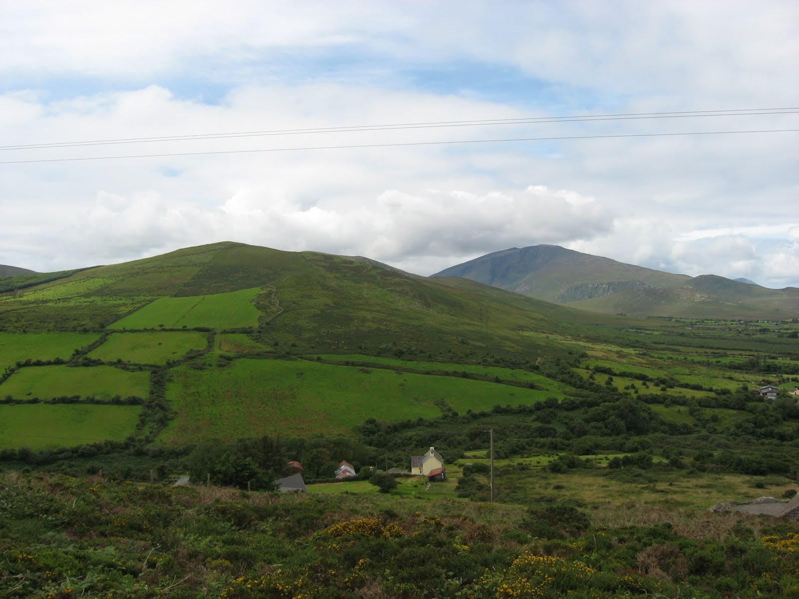
| quintessential Dingle: mountains, ocean, farms, lovely shades of green, and rock walls |
 |
| I would have taken more pictures, but Dee Dee refused to let me stop. This is the one time I got to stop and take a picture or two (and we stopped only because she had to pee.) So this is a very windblown me about half way through the loop. |
 |
| there were people swimming on this beach. I think they might be crazy. Notice the cool cave to the left of the beach... |
 |
| Since I was driving, I forced Dee Dee to go look at at least one medieval church. This is the Gallarus Oratory, built about 1000 AD by monks. It's one of the last beehive structures to be built in this area; the rest are mostly in ruins. |
 |
| Finally back in Kilrush at Crotty's Pub, where Dee Dee and I hung out with the Locals (hi Roy!) and developed a fondness for Jameson's |
No comments:
Post a Comment